- Details
-
Category: Balloons
-
Written by Blake Raab (N4BWR)

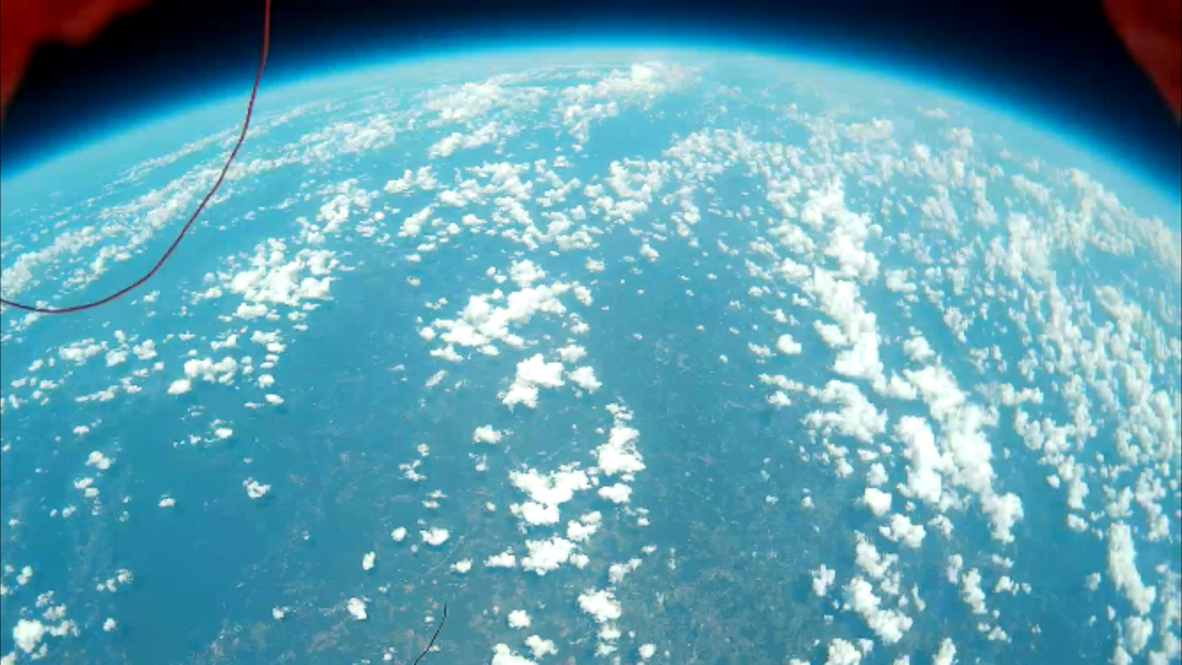
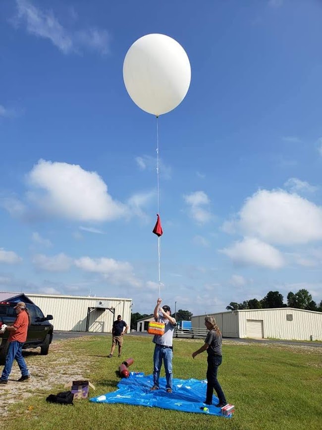
Our weather balloon launch is still a go for 7/10/2021. Current predictions have us near Oxford, and some are in the National Forest. For that reason, we will be tying 100 feet of line between the parachute and the payload. The thinking is that, if the parachute gets caught in a tall tree, the payload may still fall out and be within reach.
We will arrive at the VFW Fairgrounds in Carrollton at 9 AM and plan to launch at 10. Forecasts are still sketchy, but seem to be indicating at least scattered rain or thunderstorms. We will get the payload prepared to the point of being ready to tie it off and take the first opportunity to safely inflate, checking the radar to make sure there is no lightning in the vicinity. If there is, we may wait it out for a short time.
It's going to be an interesting day. The chase and recovery are always an adventure. Be prepared for muddy Alabama county roads, hiking, dense forests, and a recovery in tall trees! We will have plenty of stories to tell. If you have any questions about our plans, you can email This email address is being protected from spambots. You need JavaScript enabled to view it..
I have created a recovery team group text for us to maintain communication and easily exchange things like the coordinates of the estimated landing site. If you would like to be in on that group text and have not already told me, please email This email address is being protected from spambots. You need JavaScript enabled to view it..
Flight Day Resources:
- ICS-205 Incident Radio Communications Plan - For a list of the frequencies used for tracking the balloon and communication
- N4BWR's Weather Balloon Trajectory Map - Updated at least every morning with the latest prediction for launch day. After 8 AM on 7/10, that will be the operational map for launch day.
- Tracking of W4FWD-11 on aprs.fi - You can use this site on any computer or mobile device to track the flight of the balloon in real time. Click the balloon icon to see details, including altitude. You can also click on any of the previous red dots on its track for the same information at that point.
- Live Tracking Alongside Prediction - If I remember to update this file (which is a big "if"), you will be able to view the current flight path along with that day's prediction in the Google Earth app on your device. As of the time of this writing on 7/9, the predicted flight path shown in the file is for a flight we had last year.
- Find Terminal Coordinates, Given a Bearing and a Distance - This is a fun one. I have found a highly accurate method to pinpoint where the balloon will land once actual burst has happened by taking the compass heading and distance between predicted burst and predicted landing and applying that once actual burst has happened. This is the site where I will be plugging in the actual burst point and the predicted distance and heading to find the endpoint. I will certainly be announcing this information over our text group and any radio frequencies we're using at the time, but will probably also let everyone know that morning what the predicted distance and heading is so you can plug that in yourself.